


Wildfire warnings remain in effect across multiple states as persistent strong winds and dry conditions fuel the risk of rapidly spreading flames. Firefighters in several regions continue to battle active fires while emergency responders prepare for a new cross-country storm expected to bring extreme weather, including strong winds and heavy snowfall, as it moves from the Pacific Northwest toward the central and eastern U.S.
Red flag warnings are in place across the Southwest, including New Mexico and north-central Texas, where gusts of up to 40 mph, combined with relative humidity levels dropping to 10%, create an environment highly conducive to wildfires. The impact of these conditions is already being felt in New Mexico, where the Gail Fire has burned 108 acres. As of Friday, officials reported that firefighters had managed to contain approximately 25% of the blaze.
Meanwhile, in Missouri and Arkansas, the southern and northern halves of both states, respectively, face similar red flag conditions. With wind gusts reaching up to 45 mph and humidity levels ranging from 20% to 25%, fire officials remain on high alert. The Arkansas Forestry Division has reported that while 96 wildfires statewide have been contained, four new fires remain active, requiring ongoing firefighting efforts.
The division emphasized its continued coordination with local, state, and federal partners to allocate resources efficiently.
What Areas Are Facing the Highest Fire Risks?
In addition to the Southwest and Midwest, parts of Florida are also under heightened fire weather alerts. A significant stretch of southeast Florida, spanning from Orlando to Stuart, remains under red flag warnings, with elevated fire dangers extending from West Palm Beach down to Miami. Humidity levels in these areas have dropped as low as 20%, allowing existing fires to spread more easily.
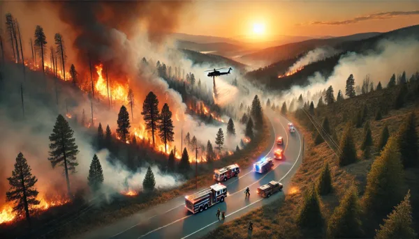
The fire risk has led to major disruptions, including the closure of U.S. 1 in both directions on Friday due to low visibility caused by smoke from the 344 wildfire in Miami-Dade County. The blaze, which has already burned 25,000 acres, is currently 30% contained, according to officials. The fire is primarily affecting unoccupied areas of the Everglades, but authorities remain cautious about its potential to spread further.
The shutdown of U.S. 1 followed a multivehicle crash earlier in the day, in which four people, including a child, sustained injuries. Miami-Dade Fire Rescue responded to the incident, highlighting the dangers posed by poor visibility from smoke in the region.
How Is Extreme Weather Contributing to Fire Risk?
The ongoing fire risks are being exacerbated by a combination of strong winds, persistent drought conditions, and low humidity, which have become increasingly common in recent years. According to climate and meteorological experts, prolonged periods of dryness, intensified by shifting weather patterns, have created an environment where even a small spark can rapidly escalate into an uncontrolled wildfire.
In Florida, where wildfires are currently active, a lack of recent rainfall and a rise in seasonal temperatures have compounded the risk. Officials have warned that conditions could deteriorate further if humidity levels remain low in the coming days.
Aside from fire risks, large portions of the U.S. are also bracing for a dramatic shift in weather patterns, with freezing temperatures expected to impact several southern states. Central Mississippi, nearly all of Alabama, and most of Georgia are under frost and freeze warnings as temperatures drop significantly. The arrival of colder air could provide temporary relief from fire concerns in some regions but will also introduce new hazards, including icy road conditions and potential agricultural damage.
What Impact Will the New Cross-Country Storm Have?
As firefighters work to contain existing wildfires, a new storm system is taking shape in the Pacific Northwest. Expected to arrive on Friday, the storm will bring widespread rain and mountain snowfall, marking the beginning of a significant weather event that will sweep across the country in the coming days.
Early forecasts indicate that Oregon could receive up to 10 inches of mountain snow by Friday evening, with Idaho and western Montana expected to accumulate between 8 and 16 inches by Saturday morning. These heavy snowfalls will likely disrupt travel in the affected regions and could also lead to localized flooding in areas where rapid snowmelt occurs.
By Sunday, the storm is projected to strengthen as it moves eastward, bringing strong winds of up to 60 mph across the Great Plains and upper Midwest. These conditions pose a heightened risk for dust storms, ground blizzards, and widespread damage to power lines and trees. Meteorologists warn that the combination of high winds and dry conditions in certain areas could further increase the wildfire threat, particularly in regions already experiencing severe drought.
How Are Officials Responding to the Crisis?
In response to the ongoing wildfire emergencies and the impending storm, state and federal agencies are ramping up preparedness efforts. Firefighters in affected areas are working around the clock to contain active blazes, while emergency response teams are preparing for potential evacuations and power outages as the storm progresses.
Local governments in fire-prone states have urged residents to stay alert and follow evacuation orders if necessary. Authorities have also advised homeowners in high-risk areas to clear dry vegetation from around their properties to reduce the likelihood of fires spreading.
In the Midwest and Great Plains, officials are bracing for the storm’s high winds, warning residents to secure loose outdoor objects and prepare for potential disruptions to transportation and power infrastructure.
What’s Next for the U.S. as Wildfire Seasons Worsen?
The persistence of red flag conditions across the U.S. highlights the growing challenges posed by increasingly volatile weather patterns. Experts point to rising global temperatures and prolonged drought conditions as key factors in the intensification of wildfires in recent years.
As climate change continues to drive extreme weather events, fire seasons are becoming longer and more destructive. While improved firefighting strategies and early warning systems have helped mitigate some risks, the frequency and severity of wildfires remain a pressing concern for communities across the country.
With a powerful storm set to sweep through the U.S. over the weekend, bringing a mix of snow, wind, and severe weather, officials are urging residents in affected areas to remain vigilant. Whether facing fire hazards or extreme winter conditions, preparation and awareness will be critical in minimizing risks and ensuring public safety.
Discover more from Business-News-Today.com
Subscribe to get the latest posts sent to your email.