


Potential Tropical Cyclone One formed near the Texas coast on June 16, 2026, raising the risk of life-threatening flash flooding from Texas into Louisiana, Mississippi, Alabama and the western Florida Panhandle as emergency officials prepared for what could become the first named storm of the 2026 Atlantic hurricane season.
The United States National Hurricane Center said the developing system was located near the South Texas coast and was expected to move northeast along the upper Texas coast before moving inland over eastern Texas or southwestern Louisiana. If the system strengthens into a tropical storm, it will be named Arthur.
The main danger is not expected to be hurricane-force wind. The greater threat is prolonged heavy rain falling over areas that are already saturated from earlier storms. Forecasts called for widespread rainfall totals of several inches, with isolated higher amounts capable of producing dangerous flash flooding and urban flooding.
Texas Governor Greg Abbott issued a disaster declaration for 101 counties on June 15, 2026, as severe storms and flood risks continued across the state. The declaration gives local officials access to state support and emergency resources as the storm threat expands across Central, South and Southeast Texas.
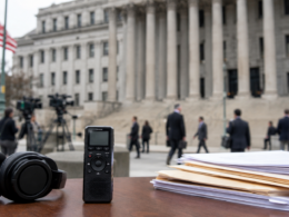
ABC News reported that Gulf Coast states already dealing with flooding were bracing for more extreme weather, while one woman died amid flooding in Texas on Monday. The developing tropical system has also placed Houston, Galveston, Port Arthur, Lake Charles and other Gulf Coast communities under heightened weather and emergency-management attention.
Why is Potential Tropical Cyclone One becoming a serious flood threat for Texas and Louisiana?
Potential Tropical Cyclone One is becoming a serious flood threat because the system is moving into a region where repeated rainfall has already increased runoff risk. When soil is saturated, additional rainfall cannot soak in quickly. Water then collects on roads, fills bayous and creeks, and overwhelms drainage systems faster than usual.
The United States National Hurricane Center warned that the system could produce heavy rainfall and dangerous flash flooding across parts of Texas and Louisiana. Even if the system remains weak or only briefly becomes Tropical Storm Arthur, the rainfall footprint could still be severe.
The institutional response shows the seriousness of the threat. Texas activated disaster-response measures, while local officials in Houston and other communities moved to prepare barricades, rescue resources and emergency communications. The storm is therefore being treated as a public-safety event rather than a routine early-season weather system.
The broader consequence is that millions of people along the Gulf Coast face risk from a storm that may not look dramatic on wind-speed charts. Tropical systems often cause the most damage through water, not wind. In this case, the flooding threat is the central story.
How are Texas officials preparing after Greg Abbott’s disaster declaration for 101 counties?
Texas officials are preparing through a statewide emergency structure that gives affected counties access to resources, coordination and rapid support. Greg Abbott’s June 15 disaster declaration covers 101 counties and allows state agencies to assist local governments as flood conditions worsen or expand.
The declaration matters because Texas is dealing with a multi-day event rather than a single storm cell. Heavy rainfall, flash flood warnings, road closures, water rescues and coastal storm impacts can occur across different parts of the state at different times. That requires a flexible response.
Emergency-management agencies are likely to focus on swiftwater rescue readiness, road closures, shelter planning, power restoration, public messaging and coordination with county officials. Flooding can escalate quickly, and the most urgent calls often involve people trapped in vehicles or homes.
The wider public-policy issue is preparedness. Texas has experienced repeated deadly flooding in recent years, making official warnings about flooded roads and rapid water rises especially important. The familiar advice not to drive through water is still one of the most important life-saving messages during flash flood events.
Why is Houston’s flood risk drawing national attention during the storm threat?
Houston’s flood risk is drawing national attention because the city is one of America’s largest metropolitan areas and is highly vulnerable to intense rainfall. Houston’s bayous, flat terrain, large paved surfaces and history of major flooding make tropical rain events especially dangerous.
The developing system threatens to bring heavy rain across Southeast Texas, where local officials have already been dealing with flood warnings and water rescues. The risk is not limited to coastal communities. Inland flooding can be just as dangerous when slow-moving rain bands repeatedly cross the same neighbourhoods.
Houston also has a major economic and infrastructure footprint. The region includes energy facilities, ports, chemical plants, transport corridors, hospitals, airports and major entertainment venues. Flooding can therefore affect not only residents but also supply chains, power systems and regional business continuity.
The timing adds pressure because Houston is also part of the wider 2026 FIFA World Cup environment, with event planning and fan activity vulnerable to severe weather disruption. Even when stadiums are covered, roads, transit, fan zones and emergency access remain exposed to flooding.
What could Tropical Storm Arthur mean for the 2026 Atlantic hurricane season?
If Potential Tropical Cyclone One becomes Tropical Storm Arthur, it would become the first named storm of the 2026 Atlantic hurricane season. That would give the season its first operational test across forecasting, warnings, emergency messaging and public response.
The potential formation of Arthur does not automatically mean the season will become unusually active. One early or mid-June storm cannot define an entire hurricane season. However, it does test coastal readiness at a time when many residents may not yet be fully prepared with hurricane supplies, flood plans or evacuation awareness.
The United States National Hurricane Center’s use of the Potential Tropical Cyclone designation also matters. The classification allows forecasters to issue watches and warnings before a system fully becomes a tropical cyclone when impacts are expected soon. That helps emergency officials act earlier instead of waiting for formal storm formation.
For the public, the key point is simple: a storm does not need a famous name or hurricane status to be dangerous. A weak tropical system can still produce life-threatening rainfall, especially when it moves slowly or tracks along a heavily populated coast.
How could the developing Gulf Coast storm affect energy, ports and local infrastructure?
The developing Gulf Coast storm could affect energy, ports and infrastructure because the Texas and Louisiana coastlines are central to United States refining, petrochemical production, offshore energy logistics and maritime transport. Heavy rain, rough seas and strong coastal winds can disrupt operations even without a major hurricane.
Reuters reported that the storm threat is being watched by the energy corridor that includes offshore drilling and onshore refineries. While the system is not expected to become a hurricane, it can still affect helicopter movement, marine operations, port activity, refinery staffing and road access.
Flooding is often the bigger operational concern. If roads around industrial facilities flood, workers may be unable to reach sites safely. Power outages, drainage failures and port restrictions can also create knock-on effects. Even short disruptions can matter when facilities operate continuously.
For local infrastructure, the storm tests drainage systems, power reliability, emergency communications and transportation planning. CenterPoint Energy and other utilities are likely to remain under scrutiny because severe weather in Southeast Texas often translates quickly into public concern over electricity reliability.
Why are Louisiana, Mississippi, Alabama and the Florida Panhandle also watching the system?
Louisiana, Mississippi, Alabama and the western Florida Panhandle are watching the system because the rainfall threat extends beyond Texas. Tropical moisture can spread far from the centre of a weak storm, especially when atmospheric steering patterns pull rain bands inland and eastward.
New Orleans and other Gulf Coast communities are particularly sensitive to flood watches because of low-lying terrain, drainage constraints and coastal exposure. Even moderate tropical rainfall can create urban flooding when pumps, canals and local drainage systems are overwhelmed.
The system may also bring rough surf, rip currents, coastal flooding and isolated tornado risks along parts of the Gulf Coast. Tropical systems often produce tornadoes in outer rain bands, especially to the east and northeast of the circulation.
The broader regional consequence is that emergency officials across multiple states must prepare at the same time. This is not only a Texas weather story. It is a Gulf Coast resilience story involving flood control, road safety, coastal warnings, power systems and emergency response capacity.
What should residents understand about the difference between storm watches and flood danger?
Residents should understand that a tropical storm watch or warning focuses on wind potential, but flood danger can be severe even when wind speeds are modest. Many people underestimate weak tropical systems because they do not look like major hurricanes on radar or satellite images.
A tropical storm watch means tropical storm conditions are possible within the watch area. A tropical storm warning means those conditions are expected. But flash flood warnings and flood watches should be treated separately because water can kill even when winds remain below damaging thresholds.
Flooding also creates hidden hazards. Roads may collapse beneath moving water, vehicles can be swept away in shallow-looking flows, and storm drains can become dangerous. Most flood deaths occur when people attempt to drive through water or underestimate how fast conditions can change.
The safest response is to follow local emergency instructions, avoid flooded roads, monitor official weather updates, keep phones charged and prepare for rapid changes. In a storm like Potential Tropical Cyclone One, the most dangerous moment may come when people assume the worst has already passed.
What are the key takeaways from Potential Tropical Cyclone One and the Gulf Coast flood threat?
- Potential Tropical Cyclone One formed near the Texas coast on June 16, 2026, creating a serious flash flood threat across Texas, Louisiana, Mississippi, Alabama and the western Florida Panhandle.
- The United States National Hurricane Center said the system could strengthen into Tropical Storm Arthur, which would make it the first named storm of the 2026 Atlantic hurricane season.
- The central threat is heavy rainfall rather than hurricane-force wind, with saturated ground increasing the risk that additional rain will quickly turn into dangerous runoff, urban flooding and road flooding.
- Texas Governor Greg Abbott issued a disaster declaration for 101 counties on June 15, 2026, giving local officials access to state support as severe storms and flood risks continue.
- Houston and Southeast Texas are under particular scrutiny because the region combines flood-prone terrain, major population centres, energy infrastructure, transport corridors and large public-event activity.
- Gulf Coast communities from Texas to Louisiana are watching for tropical storm conditions, coastal flooding, rough surf, rip currents and possible tornadoes linked to outer rain bands.
- The storm could affect energy and maritime operations even without becoming a hurricane because heavy rain, rough seas and flooded roads can disrupt refineries, ports and offshore logistics.
- Emergency officials are urging residents to avoid flooded roads, monitor official alerts and treat flash flood warnings seriously, because weak tropical systems can still produce life-threatening conditions.
Share this:
Discover more from Business-News-Today.com
Subscribe to get the latest posts sent to your email.