

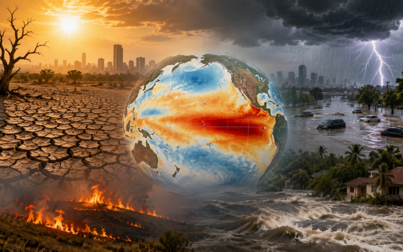
A strong El Niño is expected to intensify from August through October 2026, increasing the probability of above-normal temperatures across most of the world while shifting rainfall patterns towards drought in some regions and flooding in others.
The World Meteorological Organization issued the warning on July 31 as governments entered August facing a combination of unusually warm oceans, continued human-driven climate change and the expected development of a positive Indian Ocean Dipole.
The latest multi-model forecast projects seasonal average sea surface temperature anomalies of approximately 2.9°C in key parts of the central and eastern equatorial Pacific. The intensification is expected to continue through the coming months and may peak during November.
The 2.9°C figure refers to temperature anomalies in specific Pacific monitoring regions, not a 2.9°C increase in average global air temperature. The distinction is important because El Niño strength is assessed through ocean and atmospheric conditions in the tropical Pacific.
The forecast indicates that most land areas are likely to experience above-normal temperatures between August and October. Strong warming signals extend across Africa, southern Europe, the Arabian Peninsula, the Indian subcontinent, eastern Asia, Central America, the Caribbean, southern Africa, much of South America and New Zealand.
India faces a particularly sensitive period because the strengthening El Niño coincides with the second half of the southwest monsoon. The India Meteorological Department expects below-normal rainfall during August and projects August to September precipitation at approximately 94% of the long-period average.

Why is the World Meteorological Organization forecasting a strong El Niño from August to October 2026?
El Niño develops when surface waters in the central and eastern equatorial Pacific become warmer than normal and interact with atmospheric circulation.
The World Meteorological Organization’s August to October outlook shows that the oceanic warming is strengthening rapidly and is likely to reach the strong category during the three-month period.
El Niño is one phase of the El Niño Southern Oscillation, a natural climate system that influences global rainfall, temperature, storms and atmospheric circulation. The opposite phase, La Niña, is associated with cooler-than-normal waters in the same Pacific regions.
El Niño events usually develop between March and June, reach their greatest intensity between November and February and last approximately nine to 12 months. Their influence on global temperatures can continue after the oceanic event reaches its peak.
The current event is developing against a background of exceptionally warm oceans and elevated global temperatures. El Niño and human-driven climate change are separate processes, but they can operate together and intensify heat-related impacts.
The World Meteorological Organization uses weak, moderate, strong and very strong categories when describing El Niño. The expression “super El Niño” is widely used in public discussion but is not part of the organisation’s official operational classification.
The latest forecasts show relatively narrow differences between the major climate models, indicating high confidence that strong conditions will develop. The final peak intensity remains uncertain because ocean and atmospheric conditions can still change during the coming months.
What does the forecast 2.9°C Pacific Ocean anomaly mean for global weather patterns?
The projected 2.9°C anomaly represents the difference between forecast sea surface temperatures and the long-term average in key equatorial Pacific monitoring zones.
A stronger anomaly can produce a more powerful atmospheric response by changing tropical rainfall, cloud formation and the location of major zones of rising and sinking air.
Those changes can influence jet streams and weather systems far beyond the Pacific Ocean. The result is not a single universal effect but a pattern of increased probabilities across different regions.
Some countries may experience prolonged drought, reduced river flows and higher wildfire danger. Others may face heavy rainfall, floods, landslides and damage to transport or agricultural infrastructure.
The forecast does not mean that every location within a highlighted region will experience the same conditions. Seasonal forecasts describe the most likely average pattern over several months rather than predicting the timing of individual storms or heatwaves.
Local weather systems can temporarily produce conditions opposite to the broad seasonal outlook. A region forecast to be drier than normal may still experience destructive short-duration rainfall, while a wetter region can still undergo periods of drought.
The World Meteorological Organization therefore presents the forecast as a probability rather than a certainty. Governments must combine the seasonal outlook with national and local forecasts when making decisions involving agriculture, water, energy and disaster preparedness.
Which regions face higher drought and wildfire risks during the strengthening El Niño?
Drier-than-normal conditions are more likely across the Indian subcontinent, southern and eastern Australia, southern Central America, parts of the Caribbean, northwestern South America and northern Europe.
Reduced rainfall can lower soil moisture, weaken crop development and reduce the amount of water entering reservoirs, rivers and groundwater systems.
Australia and parts of Southeast Asia may face increased wildfire danger if vegetation dries and temperatures remain above normal. Indonesia is especially vulnerable because dry El Niño conditions can contribute to forest and peat fires.
Smoke from major fires can travel across national borders, affecting air quality, transport and public health across Southeast Asia.
Parts of Central America and the Caribbean may experience pressure on drinking water, hydropower generation and food production. Smaller islands can face additional difficulty because they possess limited freshwater storage and depend heavily on imported food.
Northwestern South America may encounter weaker rainfall while southeastern parts of the continent receive wetter conditions. This contrast can create drought and flooding within the same broader region.
Southern Africa is also exposed to agricultural and food-security risks, although the precise effects will depend on how El Niño evolves alongside Indian Ocean conditions.
Which parts of the world could receive wetter conditions and face higher flood risks?
Wetter-than-normal conditions are expected across the Greater Horn of Africa, parts of Central Asia, southern Europe, western North America south of 45 degrees north and southeastern South America.
Higher seasonal rainfall can improve reservoirs, water supplies and agricultural conditions in places recovering from drought. The same rainfall can become destructive when it arrives through intense storms or falls on saturated ground.
The Greater Horn of Africa has experienced repeated cycles of drought and flooding. Communities affected by food insecurity, displacement and weak infrastructure may struggle to absorb another extreme rainfall season.
Southern Europe could receive above-normal precipitation after experiencing severe heat and wildfire conditions. Rain may reduce fire danger but increase flash-flood and landslide risks in burned landscapes where vegetation no longer stabilises soil.
Western North America may experience wetter conditions during the forecast period, although regional outcomes will vary between coastal, mountain and inland areas.
Southeastern South America could see increased rainfall affecting Argentina, Uruguay, Paraguay and southern Brazil. Higher river levels may help agriculture and navigation but also threaten low-lying communities.
The forecast does not identify the location or timing of individual disasters. National weather agencies will need to issue shorter-term warnings as specific storm systems develop.
Why does a positive Indian Ocean Dipole increase climate risks around India and Africa?
A positive Indian Ocean Dipole develops when waters in the western Indian Ocean become warmer than normal while waters in the eastern Indian Ocean become cooler.
The World Meteorological Organization expects the positive Indian Ocean Dipole to reach an average value of approximately 0.6°C during August to October.
The Indian Ocean Dipole can alter rainfall across East Africa, the Indian subcontinent, Southeast Asia and Australia. Its effects can reinforce or partly offset the influence of El Niño depending on location and timing.
A positive phase is often associated with wetter conditions in parts of East Africa and drier conditions near Indonesia and Australia. India’s rainfall response can be more complex because several oceanic and atmospheric systems influence the monsoon.
The simultaneous development of strong El Niño conditions and a positive Indian Ocean Dipole increases uncertainty for countries around the Indian Ocean basin.
Governments must prepare for contrasting hazards. East African countries may face floods and landslides, while Australia and parts of Southeast Asia confront drought and fire risk.
The combination also has economic consequences because the Indian Ocean connects major food-producing regions, energy routes, ports and manufacturing economies. Climate disruption in several locations at the same time can affect commodity prices and supply chains.
How could the strengthening El Niño affect India’s August and September monsoon rainfall?
The India Meteorological Department expects rainfall across India to remain below normal in August. Rainfall during August and September is projected at approximately 94% of the long-period average.
The second half of the southwest monsoon is critical for kharif crops including rice, soybean, cotton, maize, pulses and oilseeds. Rainfall influences soil moisture, crop growth, reservoir storage and groundwater recharge.
India’s monsoon recovered strongly during July after a weak beginning. July rainfall finished close to normal nationally, helping farmers reduce a large early-season planting deficit.
Summer crop sowing reached approximately 78.7 million hectares by July 24, compared with 82.6 million hectares during the corresponding period a year earlier. The year-on-year shortfall had narrowed to less than 5%.
National averages nevertheless conceal large regional differences. Central India received excess rainfall during July, while eastern, northeastern and southern regions continued facing significant deficits.
A dry August could affect crops planted after the July recovery, particularly where soil moisture remains low or irrigation access is limited.
Below-normal rainfall can also reduce reservoir inflows needed for drinking water, irrigation and hydroelectric generation. The effect will depend on the distribution of rainfall rather than the national total alone.
Why could El Niño create new food inflation and humanitarian pressures worldwide?
El Niño can disrupt production of grains, oilseeds, coffee, cocoa, sugar, fruit and livestock across several regions.
Drought reduces yields and may force farmers to reduce planting or sell livestock. Floods can destroy fields, damage storage facilities and interrupt transport routes needed to move food to markets.
Simultaneous losses across several producing countries can increase global commodity prices. Import-dependent nations are especially vulnerable when currencies are weak or government budgets are already under pressure.
Higher food prices affect poorer households most severely because food represents a larger share of their total spending.
Governments may respond through subsidies, export restrictions, food reserves or emergency imports. Those measures can protect domestic consumers but may tighten international markets and increase fiscal costs.
Humanitarian agencies may face greater demand in countries already affected by conflict, displacement or economic instability. Drought and flooding can increase malnutrition, waterborne disease and population movement.
The economic effect will not be identical everywhere. Some agricultural regions may benefit from improved rainfall, while producers of certain crops could receive higher prices.
The principal risk arises when several climate-sensitive supply chains experience disruption during the same season.
How should governments prepare for the strong El Niño warning issued before August 2026?
The advance forecast gives governments time to strengthen early-warning systems, prepare emergency services and protect critical infrastructure before the most severe impacts develop.
Agricultural agencies can distribute drought-resistant seeds, adjust planting advice and prepare irrigation support for vulnerable regions.
Water authorities can review reservoir management, groundwater conditions and emergency supply plans. Decisions must account for the possibility of drought in one region and flooding in another.
Health systems should prepare for heat illness, wildfire smoke, malnutrition and diseases that spread after floods or through changes in mosquito populations.
Power utilities must assess whether heat will increase electricity demand while drought reduces hydropower output. Backup generation and fuel planning may become necessary in vulnerable systems.
Cities exposed to flooding should clear drainage systems, reinforce embankments and identify communities requiring evacuation support.
Wildfire-prone countries can position firefighters, aircraft and equipment before conditions deteriorate. Public communication should clearly explain restrictions, evacuation routes and the health effects of smoke.
Seasonal forecasts cannot prevent extreme weather, but they allow institutions to reduce exposure. The value of the warning will depend on whether governments convert probability information into practical action.
What are the key takeaways from the strong El Niño forecast for August to October 2026?
- The World Meteorological Organization expects El Niño to intensify into a strong event during August to October 2026, with the seasonal average Pacific sea surface temperature anomaly approaching approximately 2.9°C.
- The projected 2.9°C anomaly applies to key monitoring regions in the central and eastern equatorial Pacific and does not represent an equivalent increase in average global air temperature.
- Above-normal temperatures are considered likely across most land areas, including Africa, southern Europe, the Arabian Peninsula, India, eastern Asia, Central America, the Caribbean and much of South America.
- Drier-than-normal conditions are more likely across the Indian subcontinent, southern and eastern Australia, southern Central America, parts of the Caribbean, northwestern South America and northern Europe.
- Wetter-than-normal conditions are expected across the Greater Horn of Africa, parts of Central Asia, southern Europe, western North America and southeastern South America, increasing flood and landslide risks.
- A positive Indian Ocean Dipole is forecast to develop alongside El Niño, potentially strengthening drought, flood and wildfire risks across countries surrounding the Indian Ocean basin.
- The India Meteorological Department expects below-normal August rainfall and projects August to September precipitation at approximately 94% of the long-period average during a critical stage for kharif crops.
- Governments have an advance window to strengthen heat plans, water management, agricultural support, flood protection, wildfire readiness and humanitarian systems before the climate pattern reaches its expected peak.
Discover more from Business-News-Today.com
Subscribe to get the latest posts sent to your email.